

1/2

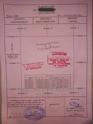
Central Region, Awutu Senya East Municipal
19 views
Surveyor Services
GyroSpatial
Company Name
We apply modern techniques to;
1. Land survey services including land demarcation, topographic surveys and crop compensation surveys
2. Site plan verification and location
3. GIS application development using Python programming
4. Sale of satellite imagery
5. Cadastral or site plan (including barcoded) preparation
and Geographic Information Systems Development
Contact for price
Safety tips
- Check Feedback to make sure the person is reliable
- Agree on the scope of work and remuneration
- Meet in person at a safe public place